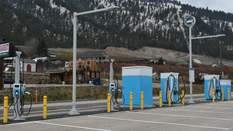
BC Hydro is adding additional public chargers to its massive charge point network across the province. The 88 chargers include 33 50 kW fast chargers, 16 25 kW chargers and 39 Level 2 chargers across 28 sites.
However, these are not new chargers; instead, BC Hydro has taken ownership of chargers that were previously operated by the BC Ministry of Transportation and Transit.
BC Hydro also confirmed that the new additions will operate on their current charge rates, which are:
- $0.2978/kWh for Level 2 chargers
- $0.3609/kWh for Fast Chargers
This latest transfer is part of BC Hydro’s commitment to support EVs across the province. The company aims to expand its charging network to include 800 charge points by spring 2026. This includes its first 400kW charger, which will debut at the end of the year.
It remains unclear whether the province plans to transfer the remaining public chargers to the hydro company. However, considering that BC Hydro already runs 70% of the chargers along the Electric Highway in the province, it might make logical sense to have a single operator rather than a mix.
BC Hydro has not confirmed an exact date for when all will be integrated into their network, but according to the news release, the chargers are expected to be live by the end of the year. The list of locations is below.
- Mile 80 Rest Area (Highway 97 north of Fort St. John)
- Boulder Creek Rest Area (Highway 37, Kitwanga, 50 km west of Hazelton)
- Thornhill Roundabout (Highway 37 at Motz Road)
- Savory Rest Area (Highway 16 west of Endako)
- Cluculz Rest Area (Highway 16 east of Vanderhoof)
- Slim Creek Rest Area (Highway 16, 120 km east of Prince George)
- Mount Terry Fox Rest Area (Highway 16, 20 km west of Mount Robson)
- Mount Robson Visitor Centre (Highway 16)
- Australian Rest Area (Highway 97, 36 km south of Quesnel)
- 100 Mile House Information Centre (Highway 97, South Cariboo Visitor Centre)
- Hanceville Lookout Rest Area (Highway 20, 85 km west of Williams Lake)
- Wire Cache Rest Area (Highway 5, between Clearwater and Avola)
- Shelter Bay Ferry Terminal (Highway 23 south of Revelstoke)
- Spillimacheen Rest Area (Highway 95, between Radium Hot Springs and Golden)
- Wasa Rest Area (Highway 93, between Canal Flats and Cranbrook)
- Una Rest Area (Highway 97, 30 km northeast of Vernon)
- Redhill Rest Area (Highway 1 south of Ashcroft)
- Port Renfrew Community Centre (Highway 14)
- Buckley Bay Rest Area (Highway 19, between Qualicum Beach and Courtenay)
- Sooke Road Park and Ride (Highway 14 at Gillespie Road)
- Woss (Highway 19)
- East Pine Rest Area (Highway 97, 70 km west of Dawson Creek)
- Little Fort Rest Area (Highway 5, between Barriere and Clearwater)
- Fishtrap Rest Area (Highway 5, between Kamloops and Barriere)
- Illecillewaet Brake Check (Highway 1, between Revelstoke and Glacier)
- Loon Lake Rest Area (Highway 97C, between Merritt and Kelowna)
- Taylor River Rest Area (Highway 4, between Port Alberni and Tofino)
- Hope Slide Viewpoint (Highway 3 east of Hope)

Always get the latest - make Drive Tesla your preferred source on Google
Are you buying a Tesla? If you enjoy our content and we helped in your decision, use our referral link to get three months of Full Self-Driving (FSD).